Address
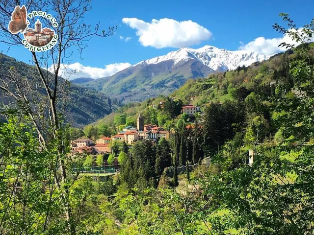
Cutigliano (PT)
GPS
44.1000671, 10.755703
Length : 6.38 km | Ascent 350 m | Descent -209 m | Highest point : 819 m
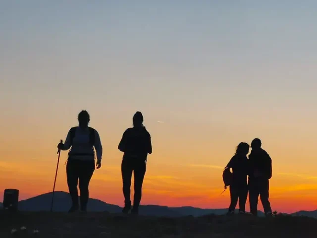
From the center of the village we head in the direction of the Church of San Bartolomeo and continue towards the promenade of San Vito. After about 1 km we find ourselves at a crossroads, take the road on the right following the signs for Podilago Pratale Cammino di San Bartolomeo. The road is immediately cool and shady with gentle slopes that lead us to the renovated Podilago mill and now a house. We cross the small iron bridge and turn left and follow the road, pass an ancient fountain and arrive at the small village of Pratale.
We notice on our left a lovely little and… mysterious church in honour of Sant’ Andrea, on whose main façade are imprinted ancient signs and symbols. Our walk continues following the fairly wide road until it crosses the Lizzanese provincial road. We cross the road along a beautiful farmhouse that has been completely renovated and we enter a forest of chestnut and acacia trees. We follow the dirt road until we come to a large water pipe. We turn left making a small but important climb following the large pipe that enters an abandoned Enel power plant. Following the road on the left, when the vegetation allows us, the beautiful views of the Libro Aperto, Cutigliano, Lizzano, Pian degli Ontani and Doganaccia open up in front of us. After a while we find a sign of the “Valle Lune” Association indicating our destination on the right: Castel di Mura. We enter through chestnut and downy oaks for a gentle climb for about 300 meters to reach the summit of Monte Castello 827 meters above sea level. Here we can admire archaeological excavations of the Castle of Mura. Below is the history of the castle taken from the website of the Valle Lune Association: “CASTEL DI MURA is mentioned in the Liber Censuum Communis Pistorii (XIV century) together with other sites in the castle: castrum de Muris situm in Montanae Superiori in villa Lizzani (Castel di Mura located in the Upper Mountain in the town of Lizzano).
The castle, built perhaps in the thirteenth century, was subsequently subjected to reconstructions dated to the first half of the fourteenth century, as attested in the Provvisioni del Comune di Pistoia, thanks to which Castel di Mura acquired military architectural characteristics and became in the center of an articulated defensive system placed to guard the border with Lucca and the road that led to Modena. it also includes the castles of Cutigliano, the fortresses of Cerreto and Sicurana.
The memory of Castel di Mura is linked to the history of the struggles between the people of Pistoia, Lucca and Florence and between the same families and factions of Pistoia that bloodied the plains and the mountains for centuries. In 1303 the fortress held by the Neri faction was besieged by the Pistoiese of the White party who, defeated, had to retreat. Two hundred men and twenty-eight horses were killed in the battle. In 1330 a commentator on Dante recalls a bloody event that occurred in Castel di Mura. Jacopo and Tommasino de’ Tedici killed Masino di Ser Orlando, Como d’Antonio and several others from Lizzano and Montagna Superiore during a dinner inside the fortress. In the same year, the Municipality of Pistoia renewed the appointment of Angelo Panciatichi as Captain of the Mountain precisely to repress the internal conflicts in the municipal territory. This is an older attestation of this magistracy that had its seat in Castel di Mura, according to some sources, from 1355 to 1361. This location in the center of the Upper Mountain and at the end of the road to Modena made the residence of this important magistrate strategic, so much so that Machiavelli described the fortress as follows: “Not a bird passes through the Upper Mountain that is not seen from Castel di Mura”.